Table of Contents >> Show >> Hide
- Why Printing “Map Only” in Google Maps Can Be Confusing
- Method 1: Print the Visible Map View Directly From Your Browser
- Method 2: Take a Screenshot of the Map and Print the Image
- Which Method Is Better?
- Bonus Tip: Use Google My Maps for Custom Maps
- Common Problems and Easy Fixes
- Best Practices for Printing a Better Map
- Final Thoughts
- Real-World Experiences: When Printing the Map Only Actually Helps
- SEO Tags
If you have ever tried to print a Google Maps page and ended up with a giant block of directions, extra side panels, or a layout that looks like it was designed by a caffeinated octopus, you are not alone. Printing just the map on Google Maps is one of those tasks that sounds ridiculously simple until you actually try to do it. Then suddenly you are three clicks deep, your printer is humming ominously, and your “clean map” now includes half the internet.
The good news is that printing the map only on Google Maps is absolutely doable. The even better news is that you do not need any fancy software, a cartography degree, or a secret handshake with your printer. In most cases, two easy methods get the job done: printing the visible map view directly from your browser, or taking a screenshot of the map and printing that image instead.
In this guide, we will walk through both methods step by step, explain when each one works best, and share a few practical tricks to make your printed map look cleaner, sharper, and less like a crime board from a detective show.
Why Printing “Map Only” in Google Maps Can Be Confusing
Google Maps makes it easy to search places, build routes, save locations, and send directions to your phone. But when it comes to printing, the standard desktop workflow is more focused on route directions than on giving you a neat, standalone map image.
That is the root of the problem. If you are printing directions, Google Maps usually gives you options like printing the route with maps or printing text only. Helpful? Yes. Perfect when you want a clean, uncluttered map? Not exactly.
And if your goal is something more visual, like printing a neighborhood map for guests, a local area map for a meeting, or a travel map to keep in the car, you usually need a workaround. Thankfully, the workaround is easy.
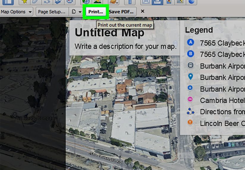
Method 1: Print the Visible Map View Directly From Your Browser
This is the fastest method for most desktop users. Instead of relying on the built-in directions print format, you set up the exact map view you want on screen and then print the page from your browser. Think of it as telling Google Maps, “Thanks, but I will take it from here.”
When this method works best
- You are using Google Maps on a desktop or laptop browser
- You want a quick printout of the map area currently on screen
- You do not need heavy editing before printing
- You want to save the map as a PDF first
How to do it
- Open Google Maps on your computer.
- Search for the location, neighborhood, or address you want.
- Zoom in or out until the map shows exactly the area you want to print.
- Close unnecessary place cards, side panels, or route details so the map takes up as much of the screen as possible.
- Use your browser’s print command. On Windows, that is usually Ctrl + P. On Mac, it is usually Command + P.
- In print preview, choose the printer or select Save as PDF if you want a digital copy first.
- Adjust layout settings if needed. Landscape often works better for wide map views.
- Print the page.
Why this method is so handy
This approach is simple because it uses tools you already have: Google Maps and your browser’s print feature. It is especially useful when you want a one-page map for travel, directions to an event, a moving checklist, or a quick backup in case your phone battery decides to stage a rebellion.
Tips for a cleaner result
- Use full screen mode if possible. The more room the map has on your display, the cleaner your print usually looks.
- Hide clutter before printing. Place cards, pop-ups, and route summaries can intrude on the map area.
- Try landscape orientation. It often fits more map detail across the page.
- Preview before printing. This saves paper, ink, and emotional stability.
- Save as PDF first. If the preview looks good, you can archive it or print later.
Pros of Method 1
- Fast and easy
- No extra apps needed
- Works well for standard map views
- Can be saved as a PDF
Cons of Method 1
- The printed layout may still include some browser or page formatting
- You have less control over cropping
- Results can vary depending on browser, printer, and screen layout
Method 2: Take a Screenshot of the Map and Print the Image
If Method 1 is the quick-and-easy option, Method 2 is the cleaner-and-more-controlled option. You arrange the map exactly how you want it, capture a screenshot, and then print that image. It is basically the “I trust myself more than the print dialog” method.
When this method works best
- You want more control over exactly what appears on the page
- You are printing from a phone, tablet, or desktop
- You want to crop out everything except the map
- You want a simple image file you can reuse later
How to do it on Windows
- Open Google Maps and adjust the zoom until the map looks the way you want.
- Hide extra panels or labels if possible.
- Use the Snipping Tool or screenshot shortcut. A common shortcut is Windows + Shift + S.
- Select the exact part of the map you want to capture.
- Save the screenshot.
- Open the image in your preferred photo viewer.
- Print it, or save it as a PDF first.
How to do it on Mac
- Open Google Maps and set up your preferred map view.
- Use the screenshot shortcut Shift + Command + 4.
- Drag over the exact part of the map you want.
- Save the screenshot to your desktop or selected folder.
- Open it in Preview or Photos.
- Print the image with the settings you want.
How to do it on a phone or tablet
On mobile, the screenshot method is often the easiest choice because the app experience is designed more for navigation and sharing than for polished printing. Set the map exactly how you want it, take a screenshot using your device’s normal screen-capture buttons, crop if needed, and print the image from your photo app or a connected printer app.
Why this method is great
A screenshot gives you precise control. You can crop tightly, remove unwanted elements, and decide exactly how much map area appears in the final print. It is also ideal if you want to email the map later, drop it into a document, or keep a reusable image for planning.
Pros of Method 2
- Better control over cropping and composition
- Works on desktop and mobile
- Easy to save, reuse, or insert into other documents
- Great for printing just the map and nothing else
Cons of Method 2
- Image quality depends on your screen resolution
- You may need to crop or resize the image before printing
- Very large map prints may look less sharp than a purpose-built export
Which Method Is Better?
It depends on what kind of map printout you need.
Choose Method 1 if:
- You want the fastest route from map to printer
- You are working on a computer
- You are okay with a basic, practical printout
Choose Method 2 if:
- You want more control over what gets printed
- You are printing from a phone or tablet
- You want a cleaner visual result
- You may reuse the map image later
If you are torn between the two, here is the honest answer: start with Method 1, and if the print preview looks messy, switch to Method 2. That is not cheating. That is called efficiency.
Bonus Tip: Use Google My Maps for Custom Maps
If you regularly need polished map printouts, Google My Maps is worth knowing about. It is a separate Google tool for building custom maps with layers, pins, routes, and notes. Unlike standard Google Maps, My Maps has its own Print map feature for custom maps.
This is especially useful for:
- Event planning
- Travel itineraries
- Real estate tours
- School projects
- Team fieldwork
That said, if your only goal is to print one map today without turning it into a hobby, the two methods above are still the easiest.
Common Problems and Easy Fixes
The print preview looks cut off
Try switching between portrait and landscape. You can also reduce scale slightly or save the page as a PDF first to see whether the issue is the browser preview or the printer settings.
The map looks too small
Zoom in before printing. A common mistake is trying to capture too much geography in one shot. Unless you are printing a treasure map for a pirate convention, smaller coverage is usually more readable.
The screenshot looks blurry
Zoom in more on the map before taking the screenshot, then crop carefully. If you need a larger print, take the screenshot on a larger screen if possible.
Too many labels or markers are showing
Standard Google Maps does not always give you total control over labels in the normal interface. Your best move is to adjust zoom, close pop-ups, and compose the cleanest view you can before printing.
You need a map for a handout or presentation
The screenshot method is usually better because it lets you place the image into a document or slide deck. Just keep map attribution visible and avoid over-editing the map image.
Best Practices for Printing a Better Map
- Print only what people need. Too much area makes a map less helpful, not more helpful.
- Use clear zoom levels. Street-level detail is great for neighborhoods; broader views are better for trip overviews.
- Test on PDF first. This lets you check spacing and clarity before using paper and ink.
- Keep attribution visible. Do not crop away the Google branding and map data credits if they appear in your view.
- Think about the reader. A map for a wedding guest is different from a map for a delivery route or classroom activity.
Final Thoughts
If you are wondering how to print the map only on Google Maps, the answer is refreshingly simple once you know the trick. The best options are either printing the visible map directly from your browser or taking a screenshot and printing the image. Both methods are easy, practical, and far less dramatic than wrestling with a cluttered directions page.
For most people, the browser print method is the fastest path. For cleaner results and tighter control, the screenshot method is the winner. And if you need custom pins, layers, or more polished travel planning, Google My Maps is a nice bonus tool to keep in your back pocket.
In other words, yes, you can print just the map. No, Google Maps does not make it quite as obvious as it should. But now you know exactly how to do it without turning a simple task into a full-blown printer side quest.
Real-World Experiences: When Printing the Map Only Actually Helps
People often assume printed maps are old-fashioned, right up until they genuinely need one. Then suddenly that little sheet of paper feels like a hero in plain clothes. One of the most common real-world experiences involves road trips through areas with weak service. You may start the day with a fully charged phone and supreme confidence, but after hours of navigation, music streaming, and family members asking whether the next gas station has snacks “that are not weird,” a printed map becomes an excellent backup plan.
Another common situation is event hosting. Imagine you are organizing a wedding, reunion, birthday party, or community fundraiser. You want guests to find the venue, the parking lot, and maybe the overflow entrance without calling you every six minutes. A simple printed Google Maps view with just the map area can be much more useful than a giant page full of turn-by-turn text. It is easier to glance at, easier to include in an email packet, and easier for guests to keep in the car.
Real estate is another place where printed map-only views still shine. Agents, homebuyers, renters, and property managers often want a quick visual of where a home sits in relation to schools, highways, parks, or major shopping areas. In those cases, a clean printed map looks more professional than handing someone a page that includes random extra panels and half a sidebar. The screenshot method is especially useful here because it lets you crop the map neatly before printing or inserting it into a flyer.
Teachers and students also run into this need more often than you might think. A classroom project about neighborhoods, landmarks, migration, local history, or geography can benefit from a simple map image that students can mark up by hand. Printed maps are still great for annotation because sometimes a pen on paper beats zooming and pinching a screen that insists on rotating at the worst possible moment.
Then there are families helping older relatives. Not everyone wants directions sent to a phone, and not everyone enjoys using navigation apps in real time. For some people, a clear printed map with the destination circled is more comfortable and less stressful. That is not outdated. That is practical. Technology is supposed to serve people, not make them audition for a customer support documentary.
Even in work settings, map-only printouts can be surprisingly useful. Delivery planning, site visits, field service jobs, volunteer outreach, and neighborhood canvassing all benefit from a simple visual reference. A one-page map can be faster to scan than a phone screen, especially when someone is juggling schedules, names, addresses, and a cup of coffee that is one speed bump away from disaster.
So yes, printing a map may sound like a small thing. But in real life, it can save time, reduce confusion, and make planning smoother. Sometimes the smartest tech move is not a complicated app trick. Sometimes it is just getting a clean map onto a piece of paper and moving on with your day like the organized genius you absolutely are.